

The City of Hillview, KY, set out to gain a clearer understanding of its roadway conditions to help guide future improvements across the community. A full pavement assessment offered the opportunity to evaluate every street and establish a reliable foundation for long-term planning.

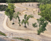
Magnolia Drive – PASER Rating 8
Clark Dietz completed this Pavement Asset Management Plan for the City in August 2025, which was completed within two months.
The project was led by Project Manager, Nick Pierce, PE, with GIS and fieldwork support from Matthew Engfer, Maria Hubert, EI, and Matthew Ginter, EIT.
The project began with a challenge unique to Hillview: an irregular city limits boundary. As part of the project scope, before any pavement assessments could begin, the team had to determine exactly which roads the City of Hillview owned and maintained. This can be a common condition for cities and villages, and while it poses a challenge, it is manageable with proper boundary verification, especially as boundaries can shift over time when communities expand.
Working with local officials, Nick, along with the project team, cross-checked Kentucky’s shapefiles, which are digital mapping files used to show boundaries and features.
“It was kind of trial and error at first until we had something to look at and could confirm things with the mayor and city staff,” Nick said.
Once everything aligned, the team had confidence in the dataset needed to move forward.
Mapping, Fieldwork, and Rating Every Roadway
With boundaries confirmed, the team collaborated to set up ArcGIS Field Maps, allowing field staff to collect data using mobile devices. GIS Analyst, Matthew Engfer, described this phase as highly collaborative:
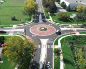
Broadland Court – PASER Rating 6
“The experience was great as a GIS analyst working on this project,” Matthew E. said. “In the world of GIS, making maps and analyzing spatial data goes nowhere without close collaboration with staff in the field collecting data. For this project, we worked closely with Maria Hubert and Matthew Ginter to provide a seamless data collection workflow and make real-time changes as they moved from road to road. We hope that the data we compiled can help the City of Hillview make informed decisions about its roads in the future.”
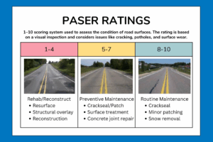
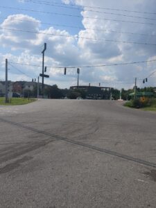
Maria and Matthew G. spent multiple days driving every single city-owned road and intersection, assigning a 1–10 PASER rating. A “1” indicated pavement needing full reconstruction; a “10” represented brand-new pavement.
PASER Scale
Complex Concepts Understood: PASER
PASER (Pavement Surface Evaluation and Rating) is a straightforward system engineers use to understand the health of a road at a glance. Instead of relying on complex measurements, PASER assigns each road a score from 1 to 10 based on what you can see on the surface.
A 10 means the pavement looks great and only needs routine care. A 1 signals a failing road that likely needs full reconstruction. Everything in between helps communities prioritize where to invest maintenance dollars, plan long-term improvements, and keep roads safe and reliable.
The data collected included pavement ratings, major and minor defects, and condition observations spread across the entire network.
After fieldwork, the project team coordinated to export the full dataset and generate a comprehensive GIS map. This map quickly became the centerpiece of the final report.
It visually highlighted pavement conditions using color-coded categories:
- Red for failing conditions (PASER 1-4)
- Yellow for fair conditions (PASER 5-7)
- Green for roads in good to excellent condition (PASER 8-10)
The map gave Hillview a clear, intuitive baseline they can compare against when they reassess their network in two years.
Supporting State Funding and Looking Ahead
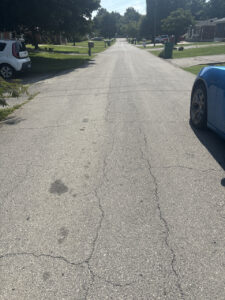
East Blue Lick Road – PASER Rating 5
The team went a step further and helped Hillview pursue additional funding through Kentucky’s LARP program. This wasn’t part of the original scope, but Nick, Client Advisor Sherry Mulkins, and Kentucky Area Manager Jonathan Rehner, PE, saw an opportunity to help the city strengthen its long-term roadway strategy.
The team identified East Blue Lick Road, a corridor with significant pavement deterioration and heavy traffic from nearby manufacturing facilities, as Hillview’s best candidate for funding.
For Nick, the project carried personal significance as well. “This was my very first Kentucky project,” he said. “It’s neat to see how the work translates from state to state, but no matter where you are, it’s about helping municipalities plan and get on the right track.”
The completed Pavement Asset Management Plan gives Hillview a reliable pavement inventory, a clear map of conditions, helpful long-term recommendations, and a data-driven foundation for future funding and improvements.

Questions? Contact Project Manager, Nick Pierce, PE.